

UK Postcode's Location and Location's Post code app for iPhone and iPad
Developer: Harmony Software UK
First release : 09 Nov 2010
App size: 1.04 Mb
UK Postcodes finder software has more than 1,900,000 UK postcodes with their location data.
* Send your location by text message sms (They can touch to the link on the sms to see your location ),
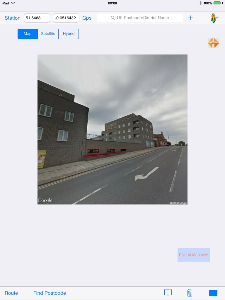
* Street view image of the postcode location or any point of the map,
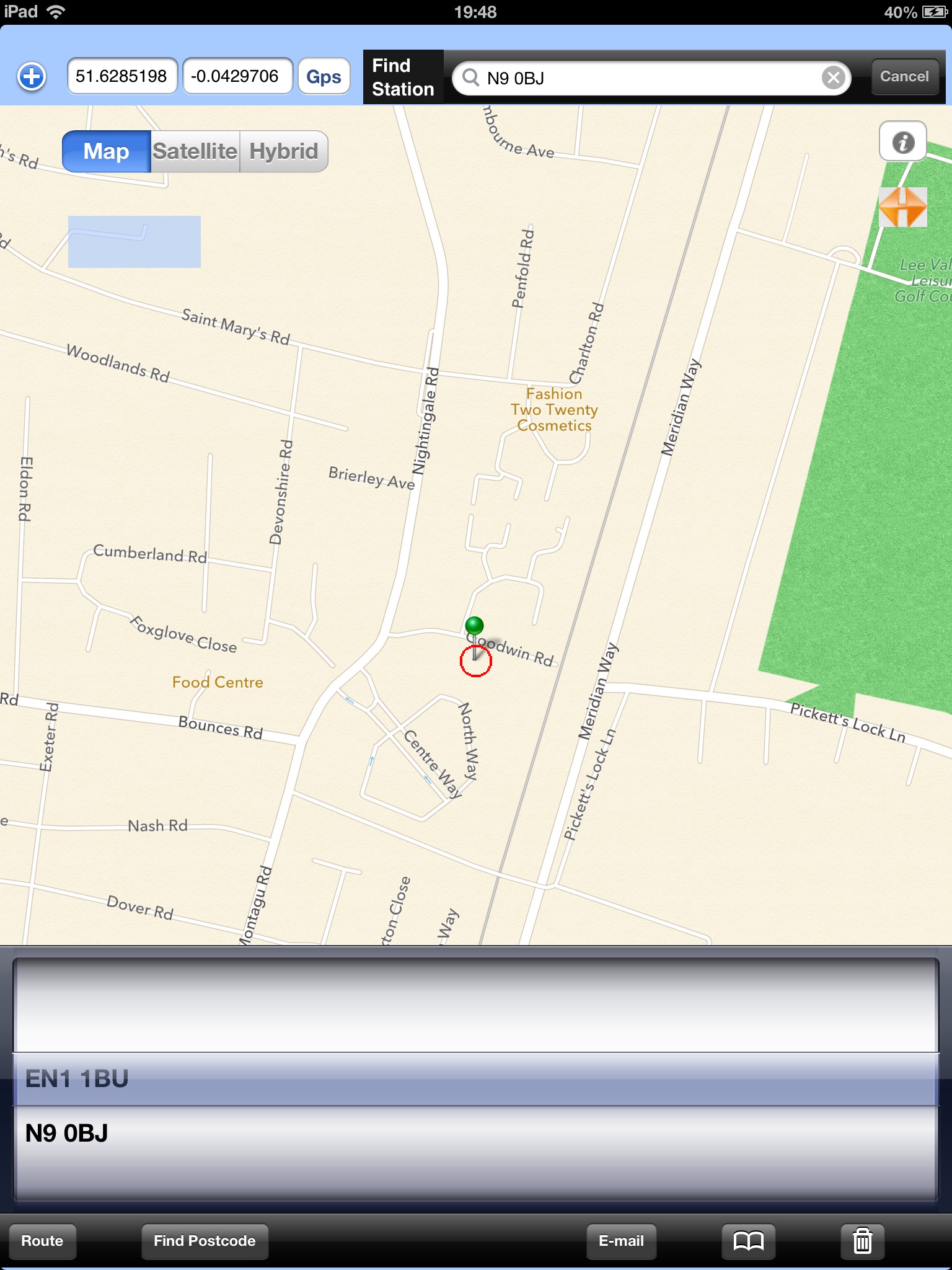
* Find your location details and town/street name information for UK postcodes,
* Find your location and nearest postcodes by clicking Postcode button.
* Find any position on the map and click code button to find nearest locations postcode to the centre of the map. So , You could find any streets postcode by just touching Postcode button on the bottom toolbar after changing your location position on the map.
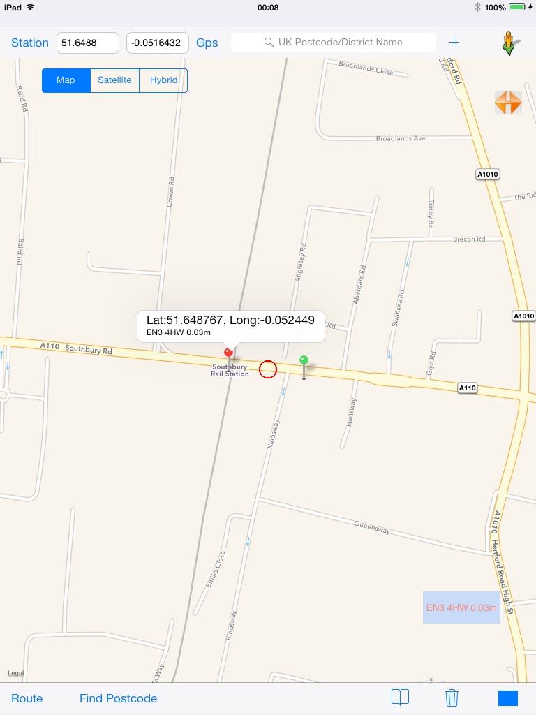
* Find nearest train/underground station. (First activate gps or select any area from map and touch to the find station button)
* View your location changes on the map with info between your location and searched postcode location,
* Use iPhone contacts list by clicking to Bookmark button.
* Save last searched postcode details with name on the favourites list and retrieve that information from the list when you need it. (So, you could save your last parking place or new club which you would like to visit to same place.)
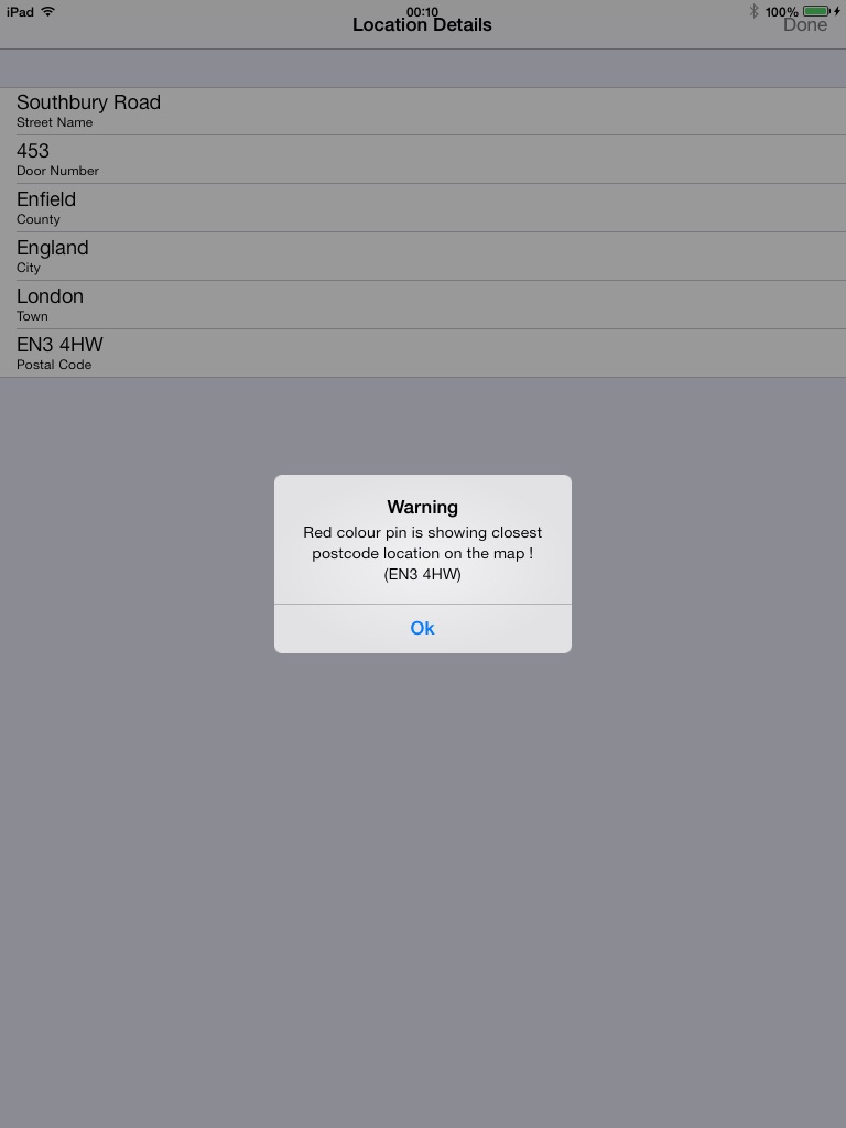
The application can show postcodes coordinates on the map as well as your live location. Also, You could click info button to see all details(Street,house number,town,etc) of your location (if there is any available informations).
You could enter postcode or UK district name(more than 3000 districts) . This application find postcodes of county/city name.
You could send searched postcode location details with E-mail.
Clear button to remove existing annotations on the mapview.
New Route option has been added. It is very easy to use route function for car/pedestrian/bus. Just, Enter any postcode or select from favourites list or select from contact list and click to the route button on the bottom toolbar. It will show you car/bus/walking routes.
This application is compatible and specially designed for iPod, iPads, iPhones.
(Continued use of GPS running in the background can dramatically decrease battery life.)
(Continued use of the flash may dramatically decrease battery life.)
(We do not accept any responsibility of not correct postcode and/or latitude/longitude data if it is not correct.)
FAQ: One of our customer asked " I have just found your post code app.. Can you click on map to find out post code for a certain street? Would be the answer to a satnavvers dreams!"
Answer: Our application already have that function. Please , open application and touch Gps button than you will see where are you on the map. Touch Gps button to stop gps. Than move your position on the map. Maybe you did not recognize in the middle of screen there is red circle which is using for finding postcode in our application. Now, Click postcode button on the bottom toolbar. Thats it. You will see your nearest postcode details on the map.